Coat of arms
Coat of arms
Via roma, 4, 10050 Mattie
The settlement of Mattie is divided into numerous hamlets scattered across the mountainous terrain on the right side of the Dora between Bussoleno and Susa. Its geographical position has led to a certain isolation compared to the fate of the villages that emerged further down along the Ancient Road of France, while it has allowed the development of a network of inter-valley relations towards the Val Chisone.
The presence of some cup-marked and engraved rocks like the Pera crevoulà suggests, as for many other locations in the valley, the presence of semi-nomadic tribes perhaps from the Bronze Age. Mattie is among the fiefs of the abbey of S. Giusto and the priory of Oulx, while feudal rights were granted to certain families such as the Farguilis, Bartolomeis, Barralis and Agnes.
Part of its mountainous territory is included within the Orsiera Rocciavrè Park, where numerous active alpine pastures can still be found during the summer months and where many hiking trails of varying difficulty start, reaching alpine lakes, refuges, and one of the most important peaks of the Susa Valley, the Orsiera.
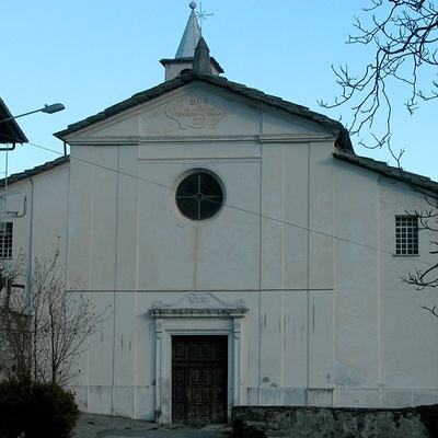
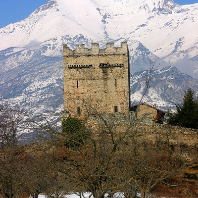
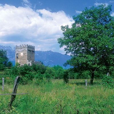
The parish church of Mattie (11th century), dedicated to Saints Cornelius and Cyprian, was expanded in 1758 with three bays with cross vaults and the elevation of a bell tower designed by the architect from Exilles, Giovanni Santo Ruscha. While isolated on a hillock, the chapel of Santa Margherita is a place of popular devotion for the community. The tower of Mattie stands on a rocky outcrop north of the Menolzio plain, dominating the small valley of the hamlets of Piccole and Grandi Tanze and visually communicating with Meana, Bussoleno (Castel Borello), and Chianocco. The fortification belonged to the feudal families of the Barralis and the Bartolomeis, who modified and expanded the construction over time. Inside, there are some frescoes with episcopal coats of arms.